
Infrastructure mapping and 3D modeling
Infrastructure Mapping and 3D Modeling
Infrastructure mapping in a digital city involves the creation of comprehensive databases and visualization tools to manage various aspects of urban infrastructure.
Gather data from various sources including government records, utility companies, satellite imagery, aerial surveys, and IoT sensors. This data may include information about roads, bridges, buildings, utilities (water, electricity, gas), telecommunications networks, transportation systems, and environmental features.
Standardize the collected data to ensure consistency and compatibility across different datasets. This may involve converting data into a common format, establishing naming conventions, and georeferencing spatial data.
Use geographic information systems (GIS) software to analyze spatial data and create digital maps. Geospatial analysis techniques such as overlay analysis, spatial querying, network analysis, and interpolation can help identify patterns, relationships, and trends within the infrastructure network.
Utilize 3D modeling techniques to represent infrastructure elements in three dimensions. This allows for more realistic visualization of urban landscapes and better assessment of spatial relationships between infrastructure components.
Develop interactive visualization tools to present infrastructure mapping data in a user-friendly manner. This may include web-based mapping applications, mobile apps, and virtual reality (VR) simulations that enable stakeholders to explore and interact with the digital city model.
Integrate infrastructure mapping data with IoT sensors and real-time monitoring systems to capture dynamic information about infrastructure performance and conditions. This enables proactive maintenance, improves service delivery, and enhances the responsiveness of city management.
Engage stakeholders including city officials, urban planners, utility providers, community groups, and residents throughout the mapping process. Solicit feedback, gather local knowledge, and involve stakeholders in decision-making to ensure that the infrastructure mapping efforts address their needs and concerns.
Establish robust data management practices to ensure the accuracy, integrity, and security of infrastructure mapping data. Implement protocols for data storage, backup, version control, and access control to safeguard sensitive information and facilitate data sharing among stakeholders.
Design the infrastructure mapping framework to be scalable and adaptable to accommodate future growth and changes in technology. Ensure that the mapping system is sustainable in the long term by investing in infrastructure, human resources, and institutional support.
Continuously update and refine the infrastructure mapping data to reflect changes in the urban environment. Monitor the performance of the mapping system, solicit feedback from users, and incorporate new data sources and technologies to enhance the accuracy and utility of the digital city model.
Gather data from various sources including government records, utility companies, satellite imagery, aerial surveys, and IoT sensors. This data may include information about roads, bridges, buildings, utilities (water, electricity, gas), telecommunications networks, transportation systems, and environmental features.
Standardize the collected data to ensure consistency and compatibility across different datasets. This may involve converting data into a common format, establishing naming conventions, and georeferencing spatial data.
Equipment

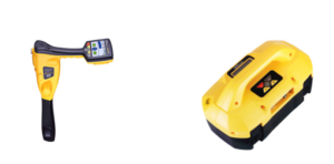
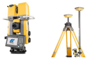
- Radan software
- V-Map
- GIS