
Scope for Digital Cities
Geophysical Modeling
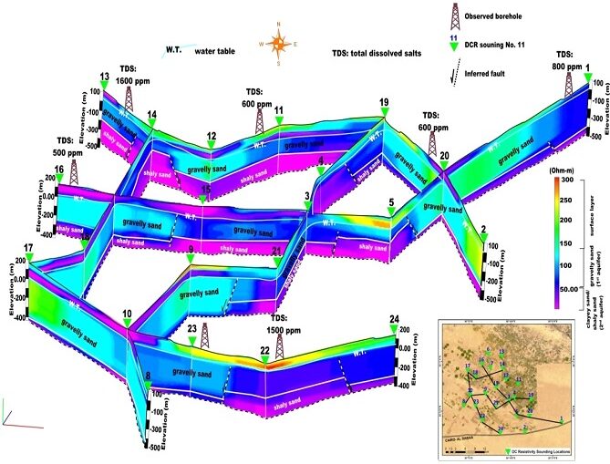
Geophysical mapping refers to the process of using various techniques to gather data about the Earth’s subsurface features and properties. The aim of geophysical mapping can vary depending on the specific goals of a project or study.
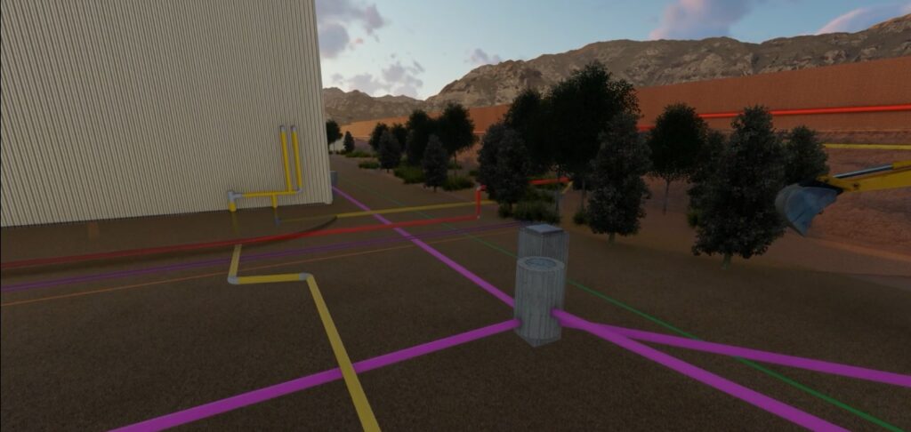
Infrastructure Mapping and 3D Modeling
3D Visualization: mapping provides a comprehensive and intuitive visualization of the entire city’s infrastructure, including utilities like water pipes, gas lines, electricity cables, and telecommunication networks. This visualization helps city planners, utility companies, and other stakeholders understand the layout and interconnections of these systems better.
Digital Transformation of water Utilities


Industrial Digitalization and Automation
Based on the infrastructure mapping and Real time hydraulic modeling results of potable water, irrigation networks, the project will focus on designing District Metered Areas (DMAs) which are smaller zones within the distribution network that are isolated and monitored to identify and quantify Non-Revenue-Water (leaks, thefts). The design will cover strategic placing of flow, pressure meters, and valves to create the desired DMAs.
Create GIS Digital Twining
The initial step involves creating a detailed map of the entire infrastructure using Geographic Information Systems (GIS) technology. This mapping provides a spatial representation of the networks, including pipes, valves, meters, and other components. Accurate GIS data is essential for subsequent analysis and modeling.
Capacity Development and Training Providing
the ability to establish professional specialized departments to serve these topics using best related instruments and providing professional training for new teams and exhibit relevant case studies serving related needs.
